A set of parameters for Kinetica.filterByRadiusGeometry(string,string,string,double,double,double,IDictionary<string, string>). More...
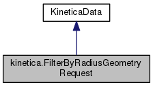
 Inheritance diagram for kinetica.FilterByRadiusGeometryRequest:
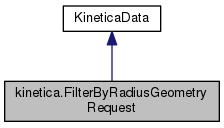
 Collaboration diagram for kinetica.FilterByRadiusGeometryRequest:
Public Member Functions | |
| FilterByRadiusGeometryRequest () | |
| Constructs a FilterByRadiusGeometryRequest object with default parameters. More... | |
| FilterByRadiusGeometryRequest (string table_name, string view_name, string column_name, double x_center, double y_center, double radius, IDictionary< string, string > options=null) | |
| Constructs a FilterByRadiusGeometryRequest object with the specified parameters. More... | |
 Public Member Functions inherited from kinetica.KineticaData Public Member Functions inherited from kinetica.KineticaData | |
| KineticaData (KineticaType type) | |
| Constructor from Kinetica Type More... | |
| KineticaData (System.Type type=null) | |
| Default constructor, with optional System.Type More... | |
| object | Get (int fieldPos) |
| Retrieve a specific property from this object More... | |
| void | Put (int fieldPos, object fieldValue) |
| Write a specific property to this object More... | |
Properties | |
| string | table_name [get, set] |
| Name of the table on which the filter by radius operation will be performed. More... | |
| string | view_name [get, set] |
| If provided, then this will be the name of the view containing the results. More... | |
| string | column_name = "" [get, set] |
| Name of the geospatial geometry column to be filtered. More... | |
| double | x_center [get, set] |
| Value of the longitude of the center. More... | |
| double | y_center [get, set] |
| Value of the latitude of the center. More... | |
| double | radius [get, set] |
| The radius of the circle within which the search will be performed. More... | |
| IDictionary< string, string > | options [get, set] |
| Optional parameters. More... | |
 Properties inherited from kinetica.KineticaData Properties inherited from kinetica.KineticaData | |
| Schema | Schema [get] |
| Avro Schema for this class More... | |
Additional Inherited Members | |
 Static Public Member Functions inherited from kinetica.KineticaData Static Public Member Functions inherited from kinetica.KineticaData | |
| static RecordSchema | SchemaFromType (System.Type t, KineticaType ktype=null) |
| Create an Avro Schema from a System.Type and a KineticaType. More... | |
Detailed Description
A set of parameters for Kinetica.filterByRadiusGeometry(string,string,string,double,double,double,IDictionary<string, string>).
Calculates which geospatial geometry objects from a table intersect a circle with the given radius and center point (i.e. circular NAI). The operation is synchronous, meaning that a response will not be returned until all the objects are fully available. The response payload provides the count of the resulting set. A new resultant set (view) which satisfies the input circular NAI restriction specification is also created if a view_name is passed in as part of the request.
Definition at line 26 of file FilterByRadiusGeometry.cs.
Constructor & Destructor Documentation
◆ FilterByRadiusGeometryRequest() [1/2]
|
inline |
Constructs a FilterByRadiusGeometryRequest object with default parameters.
Definition at line 64 of file FilterByRadiusGeometry.cs.
◆ FilterByRadiusGeometryRequest() [2/2]
|
inline |
Constructs a FilterByRadiusGeometryRequest object with the specified parameters.
- Parameters
-
table_name Name of the table on which the filter by radius operation will be performed. Must be an existing table. view_name If provided, then this will be the name of the view containing the results. Must not be an already existing collection, table or view. column_name Name of the geospatial geometry column to be filtered. x_center Value of the longitude of the center. Must be within [-180.0, 180.0]. The minimum allowed value is -180. The maximum allowed value is 180. y_center Value of the latitude of the center. Must be within [-90.0, 90.0]. The minimum allowed value is -90. The maximum allowed value is 90. radius The radius of the circle within which the search will be performed. Must be a non-zero positive value. It is in meters; so, for example, a value of '42000' means 42 km. The minimum allowed value is 0. The maximum allowed value is MAX_INT. options Optional parameters.
Definition at line 90 of file FilterByRadiusGeometry.cs.
Property Documentation
◆ column_name
|
getset |
Name of the geospatial geometry column to be filtered.
Definition at line 40 of file FilterByRadiusGeometry.cs.
◆ options
|
getset |
Optional parameters.
Definition at line 59 of file FilterByRadiusGeometry.cs.
◆ radius
|
getset |
The radius of the circle within which the search will be performed.
Must be a non-zero positive value. It is in meters; so, for example, a value of '42000' means 42 km. The minimum allowed value is 0. The maximum allowed value is MAX_INT.
Definition at line 56 of file FilterByRadiusGeometry.cs.
◆ table_name
|
getset |
Name of the table on which the filter by radius operation will be performed.
Must be an existing table.
Definition at line 31 of file FilterByRadiusGeometry.cs.
◆ view_name
|
getset |
If provided, then this will be the name of the view containing the results.
Must not be an already existing collection, table or view.
Definition at line 36 of file FilterByRadiusGeometry.cs.
◆ x_center
|
getset |
Value of the longitude of the center.
Must be within [-180.0, 180.0]. The minimum allowed value is -180. The maximum allowed value is 180.
Definition at line 45 of file FilterByRadiusGeometry.cs.
◆ y_center
|
getset |
Value of the latitude of the center.
Must be within [-90.0, 90.0]. The minimum allowed value is -90. The maximum allowed value is 90.
Definition at line 50 of file FilterByRadiusGeometry.cs.
The documentation for this class was generated from the following file:
- Kinetica/Protocol/FilterByRadiusGeometry.cs


